
Learn how TravelTweaks maps and TweakMaps work, from custom pins and layers to smarter routes, offline planning, trip tweaks, and collaborative travel maps.
Travel planning usually starts out organized. Then, somehow, you end up with 27 browser tabs, screenshots of restaurants, hotel confirmations buried in your email, and a Notes app full of places you can’t remember saving.
That’s the problem TravelTweaks maps and TweakMaps are designed to address.
Instead of treating a map as something you open only when you need directions, the TweakMaps approach turns it into a visual travel-planning workspace. You can organize attractions, restaurants, hotels, routes, notes, and priorities around the geography of your actual trip. TravelTweaks’ published guides describe features such as customizable pins, layers, annotations, route organization, sharing, and offline preparation.
The result is less time jumping between apps and more time understanding how your trip actually fits together.
Here’s how it works and, more importantly, how to use it effectively.
What Is TravelTweaks, and Where Does TweakMaps Fit In?
The easiest way to understand the concept is to separate travel information from map organization.
TravelTweaks provides destination and trip-planning guidance, while its map-guide approach uses TweakMaps to organize that information geographically. TravelTweaks describes these guides as resources that help travelers understand destinations, nearby places, possible routes, and how different areas connect rather than simply displaying point-to-point directions.
Think about planning three days in Rome.
A normal map can show your hotel and the Colosseum.
A useful travel map should help you see much more:
- Which attractions are near the Colosseum?
- Which restaurants have you saved in that area?
- What should you visit on the same day?
- Which places are must-sees and which are optional?
- Where is your hotel relative to everything?
- Which route makes geographical sense?
- What happens if rain changes your plan?
- Which information should remain accessible without internet?
That’s where the TweakMaps idea becomes useful.
Instead of thinking “How do I get from A to B?”, you’re thinking “How should this entire day fit together?”
What Makes Map Guides TTweakMaps from TravelTweaks Different?

There are already excellent mapping and navigation tools available, so another map only makes sense if it solves a different problem.
TravelTweaks’ guides focus heavily on planning context.
Rather than simply finding a destination, the idea is to understand how attractions, neighborhoods, food stops, accommodation, and transportation relate to each other.
They Hit the Right Balance Between Detail and Simplicity
Travel maps become useless surprisingly quickly when you add too much information.
Imagine opening a map containing 130 identical pins.
Technically, you’ve saved everything.
Practically, you’ve created a mess.
TweakMaps guides recommend separating information through custom layers, pin styles, categories, and annotations so travelers can filter what they’re looking at.
For example:
Red: Must-see attractions
Green: Restaurants
Blue: Accommodation
Yellow: Optional activities
Purple: Nightlife
Orange: Transportation
You can go further by creating separate layers for each day.
The point isn’t to add as much information as possible. It’s to make the information understandable when you’re standing on a street corner with 10% battery.
They’re Built for Real Conditions, Not Ideal Ones
A travel itinerary that works perfectly on paper can fall apart once you arrive.
The museum takes longer than expected.
It rains.
A restaurant is closed.
Traffic turns a 20-minute drive into 50 minutes.
Someone in your group doesn’t want to walk another three miles.
TravelTweaks’ approach emphasizes looking beyond raw distance and considering actual travel conditions. Its guidance for short layovers, for example, recommends accounting for airport exit time, transportation, traffic, walking, luggage, security, and the time needed to return rather than simply looking at the distance between two pins.
That’s a useful principle for any trip.
Distance isn’t the same thing as usable travel time.
They Evolve With Community Input
Travel planning becomes much better when recommendations aren’t limited to the obvious tourist attractions.
TravelTweaks specifically encourages travelers to examine neighborhood streets, cafés, markets, community spaces, natural areas, and surrounding locations rather than focusing entirely on headline attractions.
Community recommendations can be particularly valuable here.
Someone might tell you about a bakery two streets behind your hotel or a viewpoint that’s much better at sunset.
Instead of saving those recommendations as screenshots, add them directly to the map.
That turns random advice into something geographically useful.
Core Features of TweakMaps
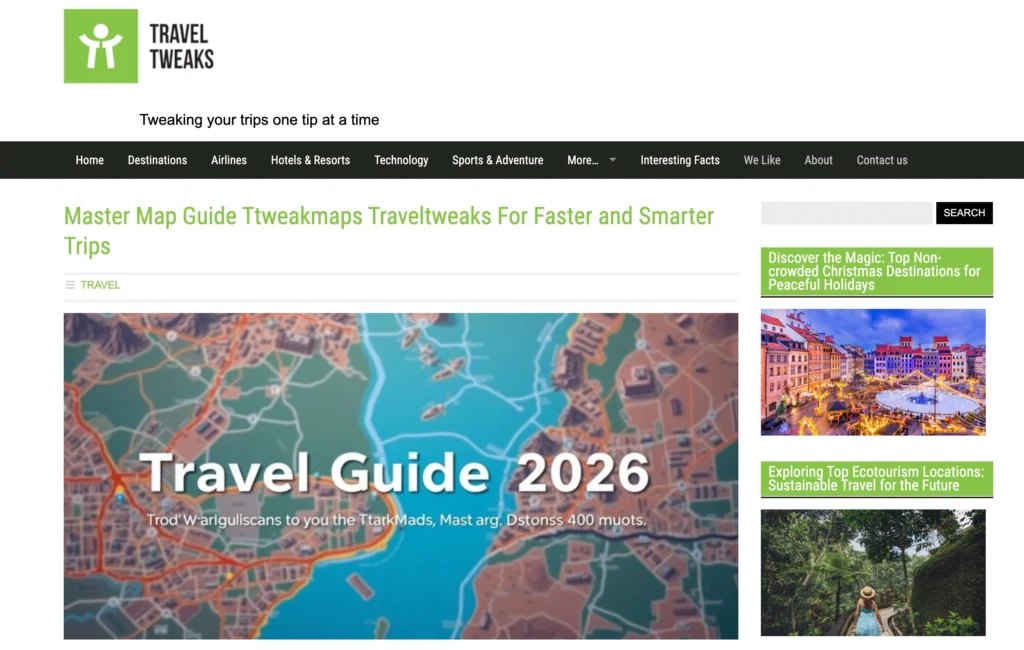
The most useful TweakMaps features are the ones that reduce travel-planning clutter.
TravelTweaks’ published map guides describe a toolset built around custom markers, layers, notes, routes, filters, imports, exports, sharing, and offline access.
Here’s how those features translate into actual travel planning.
| Feature | What It Does | Best Use |
|---|---|---|
| Custom pins | Marks specific locations | Attractions and restaurants |
| Color coding | Separates priorities/categories | Fast visual planning |
| Layers | Groups related locations | Different days or themes |
| Notes | Stores useful details | Tickets, opening times, tips |
| Routes | Connects planned stops | Daily sightseeing |
| Filters | Hides unnecessary information | Keeping maps readable |
| Sharing | Gives others access | Group travel |
| Offline preparation | Keeps key map data available | International/outdoor trips |
| Imports | Adds existing location data | Large itineraries |
| Exports | Creates backups/shareable files | Trip records |
The layer system is especially useful.
Imagine a five-day Japan trip. Instead of dumping everything onto one map, you might create:
- Tokyo Day 1
- Tokyo Day 2
- Kyoto
- Food
- Hotels
- Transport
- Backup activities
Turn off everything except the information you need that day.
Suddenly, a complicated itinerary becomes much easier to read.
Who Should Use TweakMaps?
TweakMaps makes the most sense for travelers who like some structure but don’t want every minute scheduled.
Independent travelers can use it to organize research.
Couples can combine saved recommendations instead of constantly sending each other links.
Families can separate kid-friendly activities, restaurants, bathrooms, parks, and backup indoor attractions.
Road trippers can organize fuel stops, hotels, viewpoints, restaurants, and detours along one route.
Travel bloggers and photographers can mark photo locations, sunrise viewpoints, hotels, restaurants, and content stops.
Group travelers can share a common plan rather than having six different versions of the itinerary.
TravelTweaks also describes map sharing and editable access as useful for collaborative planning.
For Business Travelers
Business travel is an especially good use case because time matters more.
Suppose you’re flying into London for a conference.
You have:
- Airport
- Hotel
- Conference venue
- Client dinner
- Coworking space
- Two meetings
- Train station
- One free afternoon
Put everything on one map and you immediately see whether your accommodation actually makes sense.
Maybe the cheaper hotel saves $40 per night but adds 45 minutes of transportation every morning.
That isn’t really cheaper if your time matters.
You can also create a separate “Free Time” layer containing nearby restaurants, coffee shops, gyms, attractions, and shopping.
Then if a meeting gets canceled, you already know what’s nearby.
How the Tweaks System Works?

The best way to understand “tweaks” is as small changes that turn a generic travel map into your map.
You start broad.
Step 1: Add Everything
First, pin the places you’re genuinely considering.
Don’t worry about the order yet.
Add attractions, restaurants, accommodation, transport hubs, viewpoints, and anything else important.
Step 2: Look for Geographic Clusters
Now stop looking at your wishlist and look at the map.
This is where good itinerary planning begins.
If five attractions sit within the same neighborhood, they probably belong on the same day.
TweakMaps guidance similarly recommends identifying clusters and arranging stops geographically rather than blindly following the order of a wishlist.
Step 3: Create Categories
Separate food, attractions, nightlife, hotels, and transportation.
Then mark priorities.
I like a simple system:
A: Absolutely doing it
B: Would like to do it
C: Only if there’s time
This prevents your itinerary from becoming impossible.
Step 4: Connect Your Route
Once you’ve identified clusters, connect stops in a logical order.
Look at actual travel time rather than straight-line distance.
A river, highway, hill, transit line, or pedestrian restriction can completely change what “nearby” means.
Step 5: Add Backup Options
This is the tweak most people forget.
Create a layer called Plan B.
Add indoor attractions, nearby cafés, alternative restaurants, and activities that don’t require reservations.
When something goes wrong, you don’t need to restart your research.
Real-World Use Case: Three Days in Prague
Let’s say I’m planning three days in Prague.
I’ve saved Prague Castle, Charles Bridge, Old Town Square, several restaurants, a brewery, museums, viewpoints, and cafés.
Instead of visiting them in random order, I’d build geographical clusters.
Day 1: Old Town
Old Town Square → Astronomical Clock → Jewish Quarter → nearby restaurant → evening walk.
Day 2: Castle Side
Prague Castle → St. Vitus Cathedral → Malá Strana → Charles Bridge → dinner.
Day 3: Flexible Prague
Museums → neighborhood exploration → cafés → viewpoints → anything missed during Days 1 and 2.
The advantage isn’t simply having pins.
It’s realizing that crossing the city repeatedly makes no sense.
I’d also add:
- Hotel
- Main train station
- Airport connection
- Emergency pharmacy
- Two backup restaurants
- Rainy-day attractions
- Sunset viewpoint
Now the map is doing actual planning work.
AI and Technology Behind the Platform
This is where it’s worth separating useful technology from marketing language.
Travel planning tools increasingly use automation and data processing to help with routing, organization, recommendations, and travel-time estimation. TravelTweaks’ own published material describes route logic, travel-time considerations, custom layers, filters, and multi-modal route planning across walking, driving, and transit scenarios.
But AI shouldn’t make every decision.
I wouldn’t let any algorithm blindly decide where I eat, which neighborhood I explore, or how long I spend inside a museum.
The better approach is:
Technology organizes. You decide.
Use automated suggestions to find possibilities.
Then apply human judgment based on your budget, interests, energy, mobility, weather, and travel style.
That’s what turns a technically efficient itinerary into a good vacation.
Practical Tips for Getting the Most Out of TweakMaps

A travel map is only useful if you can understand it quickly.
The biggest mistake people make with interactive maps is saving absolutely everything they find. After a few weeks of research, the map becomes covered with hundreds of pins and is almost as confusing as having no plan at all.
A better approach is to make every pin earn its place.
Here are the practical rules I’d use.
1. Use Different Layers for Different Days
Don’t keep a seven-day vacation on one visible layer.
Separate your itinerary into Day 1, Day 2, Day 3, and so on. You can also create permanent layers for hotels, transportation, restaurants, and emergency information.
When you’re exploring Day 2, hide the locations you won’t need until Day 5.
Your map immediately becomes cleaner.
2. Color-Code by Purpose
Colors should tell you something.
For example:
- Red: Must-see attractions
- Green: Restaurants and cafés
- Blue: Hotels
- Purple: Nightlife
- Orange: Transportation
- Yellow: Optional stops
You shouldn’t need to open every pin just to remember why you saved it.
3. Add Useful Notes
A pin called “Museum” doesn’t tell you much.
A better note might include the opening time, ticket requirement, estimated visit length, and why you saved it.
You could write:
“Book online. Closed Monday. Allow 2 hours. Good rainy-day option.”
That tiny note could save you a wasted journey.
4. Plan Around Clusters, Not Rankings
Suppose your top-rated restaurant is 45 minutes away, but there’s another excellent restaurant five minutes from your afternoon attraction.
The second restaurant may be the better choice.
TravelTweaks’ mapping guidance emphasizes grouping nearby locations and considering realistic travel times when organizing daily routes. (traveltweaks.com)
Good travel planning isn’t about individually selecting the “best” attraction, café, and restaurant.
It’s about creating the best overall day.
5. Keep Some Empty Time
Interactive maps can encourage overplanning because adding another pin is so easy.
Resist it.
If your route contains 12 attractions in one day, you probably haven’t created an efficient itinerary. You’ve created a race.
I usually prefer three or four major activities with optional nearby stops.
That gives you room to stay longer somewhere you enjoy.
6. Prepare Before Going Offline
TravelTweaks’ guides recommend preparing offline maps or exported information before heading somewhere with unreliable connectivity. (traveltweaks.com)
Do this while you’re still at your hotel or connected to reliable Wi-Fi.
Don’t wait until you’re standing on a mountain with one bar of signal.
For international trips, I also keep screenshots of:
- Hotel address
- Important tickets
- Airport transfer details
- Train information
- Passport information page
- Emergency contacts
An interactive map is useful, but having a simple backup remains smart.
TweakMaps for Nature and Outdoor Travel
Interactive mapping becomes even more valuable once you leave cities.
In Paris, getting lost might mean walking an extra ten minutes and finding a bakery.
On a remote hiking route, navigation mistakes can have much more serious consequences.
TravelTweaks’ outdoor mapping guidance focuses on using map information to understand terrain, elevation, route difficulty, water sources, campsites, viewpoints, and trail conditions rather than simply navigating from one point to another.
For outdoor travel, I’d create separate categories for:
Trailheads: Where the actual route starts.
Parking: Because the parking lot and trailhead aren’t always in the same place.
Water: Known refill or water-access points.
Shelters and campsites: Essential for multi-day trips.
Viewpoints: Useful for photography and rest stops.
Exit routes: Alternative ways out if weather or injury changes the plan.
Emergency locations: Ranger stations, roads, hospitals, or rescue points.
Never Rely on One Digital Map Outdoors
This deserves emphasis.
For serious hiking, wilderness travel, or remote road trips, TweakMaps or any other digital mapping platform should not be your only navigation system.
Phones break.
Batteries die.
GPS can behave unpredictably.
Offline downloads can fail.
Weather can make planned routes unsafe.
Carry an appropriate backup, especially on remote trips. Depending on the activity, that could mean a paper topographic map, compass, dedicated GPS device, satellite communicator, or another offline navigation system.
And always check official trail conditions before leaving.
A community recommendation from six months ago isn’t enough to confirm that a trail is currently open or safe.
Comparing TweakMaps to Other Mapping Tools
TweakMaps doesn’t exist in a vacuum.
Travelers already have several excellent mapping and itinerary tools available, including Google Maps, Apple Maps, and specialized trip-planning applications.
So why use a TravelTweaks-style map at all?
Because these tools solve slightly different problems.
| Feature | TweakMaps Approach | Standard Navigation Apps | Traditional Travel Guide |
|---|---|---|---|
| Turn-by-turn navigation | Not primary focus | Excellent | No |
| Custom trip organization | Strong focus | Moderate | Limited |
| Day-by-day layers | Useful | Varies | No |
| Personal notes | Yes | Usually basic | No |
| Destination context | Strong | Limited | Strong |
| Route visualization | Yes | Excellent | Limited |
| Community input | Part of approach | Extensive on major apps | Varies |
| Offline preparation | Useful | Often available | Naturally offline if printed |
| Collaborative planning | Useful | Varies | Limited |
| Personalized trip structure | Strong | Moderate | Low |
TweakMaps vs. Google Maps
Google Maps is extremely difficult to beat for everyday navigation.
Its strengths include directions, traffic information, business listings, reviews, public transportation, and general location discovery.
I wouldn’t replace it.
Instead, I’d use TweakMaps-style planning before and around navigation.
Think of it this way:
TweakMaps: What should I do today, and how does everything fit together?
Google Maps: What’s the best way to get to the next stop right now?
Those jobs overlap, but they aren’t identical.
TweakMaps vs. Apple Maps
Apple Maps works especially well for travelers already inside Apple’s ecosystem.
It’s excellent for straightforward navigation and integrates naturally with iPhones and other Apple devices.
Again, the distinction comes down to planning depth.
A dedicated travel-planning map can contain the broader structure of your vacation, while Apple Maps handles the actual movement between locations.
TweakMaps vs. Static Travel Guides
This is where interactive mapping has a clear advantage.
Imagine a traditional article saying:
Visit the castle in the morning, have lunch at Restaurant X, then visit Museum Y.
Sounds fine.
But what if Restaurant X is actually 35 minutes in the opposite direction?
A map makes that immediately obvious.
Static guides are excellent for understanding why a place is worth visiting.
Maps are better at understanding where it fits into your day.
The smartest approach combines both.
Read detailed destination information first, then organize the places that interest you geographically.
TweakMaps vs. Spreadsheet Itineraries
I’m a fan of spreadsheets for complicated travel.
They’re excellent for flights, hotel confirmation numbers, costs, dates, reservation times, and budgeting.
But spreadsheets are terrible at geography.
A row saying “Charles Bridge, 2 PM” doesn’t visually tell you that your 1 PM restaurant is on the other side of Prague.
The map does.
Use your spreadsheet for logistics and your interactive map for geography.
Final Thoughts
The best travel-planning tools don’t tell you exactly what your vacation should look like.
They help you make better decisions.
That’s where TravelTweaks maps and the TweakMaps approach are most useful.
Instead of collecting restaurants in one app, attractions in another, screenshots in your photo gallery, hotel details in your inbox, and random recommendations in WhatsApp messages, you organize the geographical side of your trip around one visual structure.
That sounds simple.
But geography is where a surprising number of travel itineraries go wrong.
A traveler finds the five highest-rated attractions and assumes they can comfortably visit them in one day.
A restaurant looks “nearby” until you discover there’s a river between you.
A cheap hotel turns out to require an hour of transportation every morning.
A three-hour layover looks long enough for sightseeing until airport security and transportation are included.
Mapping everything exposes those problems early.
The most useful TweakMaps workflow is also the simplest:
- Save the places you’re genuinely interested in.
- Separate them into useful categories.
- Look for geographic clusters.
- Build each day around those clusters.
- Add realistic travel time.
- Keep backup options nearby.
- Prepare essential information for offline use.
- Change the plan when real conditions demand it.
That final point matters most.
No interactive map, AI system, itinerary generator, or travel expert can predict exactly how your trip will unfold.
Maybe Prague gets three days of rain.
Maybe the little restaurant you added as a backup becomes your favorite meal.
Maybe you planned two hours at a museum and leave after 45 minutes.
Or maybe you find a neighborhood you love and abandon half the day’s itinerary.
That’s not bad planning.
That’s travel.
The purpose of a good map isn’t to lock you into a schedule. It’s to show you your options clearly enough that changing the schedule becomes easy.
And that’s ultimately where the TravelTweaks TweakMaps concept makes the most sense: not as a replacement for navigation apps or traditional travel guides, but as the visual layer connecting your research with the reality of moving through a destination.
Use it to organize.
Use navigation tools to get around.
Use official sources to verify opening hours, transportation, weather, and trail conditions.
Then leave enough space in the itinerary for the unexpected.
Because the best travel map should help you explore a destination, not make you spend the entire vacation staring at your phone.